
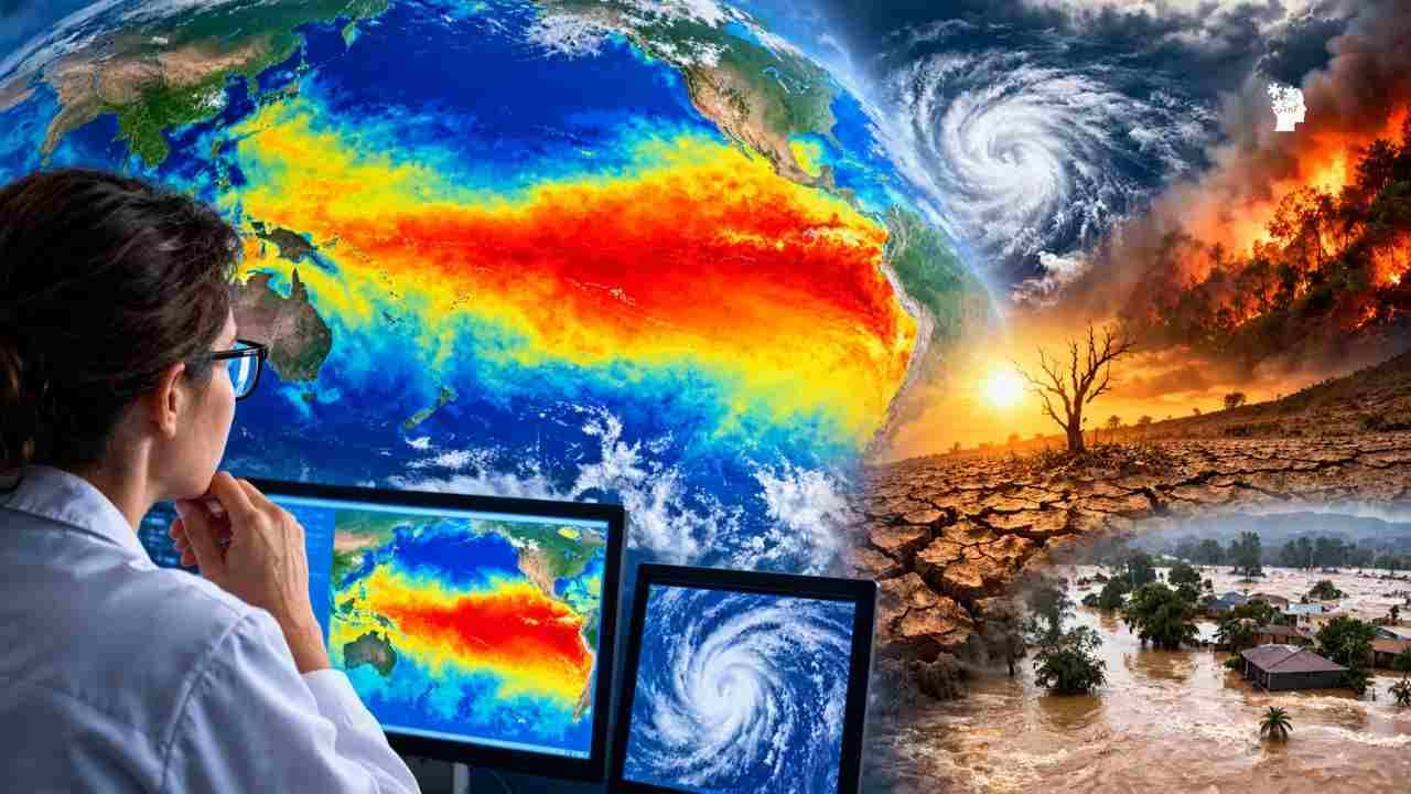
A powerful El Niño is rapidly intensifying in the tropical Pacific—and scientists are watching closely as ocean temperatures approach territory rarely seen in modern records.
Something unusual is happening thousands of miles west of the Americas.
The tropical Pacific Ocean is becoming exceptionally warm, and the developing 2026–27 El Niño is already showing signs of becoming one of the strongest events in modern observations.
NOAA says El Niño is strengthening and gives it a greater than 90% chance of becoming a very strong event during the Northern Hemisphere fall and winter. For October through December, NOAA currently estimates a 75% chance that the event will reach a historic strength exceeding previous El Niños recorded since 1950.
But there is another reason scientists are paying attention.
A recent study using centuries-old and fossilized corals from the Galápagos Islands found that El Niño events during the last four decades have been substantially stronger than those reconstructed from much of the previous 1,000 years.
So the obvious question is:
Could the El Niño developing right now become one of the strongest ever observed?
The answer is still uncertain—but the warning signs are getting harder to ignore.
Table of Contents
The Pacific has already broken important records
El Niño is not simply a “hot ocean.”
It is a large-scale climate phenomenon involving a complex interaction between tropical Pacific ocean temperatures, winds and atmospheric circulation.
During a strong El Niño, unusually warm water spreads across the central and eastern tropical Pacific. That enormous reservoir of heat can then influence atmospheric circulation far beyond the Pacific.
And in 2026, the ocean has been warming at an extraordinary pace.
NOAA’s September assessment reported sea-surface temperature anomalies exceeding 3°C above average in parts of the eastern equatorial Pacific. Subsurface waters were also exceptionally warm, with widespread anomalies exceeding 10°C at depth.
That combination matters because the water beneath the surface can provide additional heat that later reaches the surface.
In other words, the Pacific isn’t simply warm at the top.
There is a huge amount of unusual heat stored below it as well.
Why scientists are talking about 1,000 years
The “1,000 years” claim needs some explanation.
Scientists obviously did not have modern thermometers measuring the Pacific in the year 1200.
Instead, researchers can use natural archives.
One particularly useful archive is coral.
Corals grow layer by layer, and the chemistry of those layers can preserve information about the temperature of the surrounding seawater.
Researchers studying modern and fossilized corals from the Galápagos Islands reconstructed ancient El Niño behavior going back roughly a millennium.
Their findings were striking.
The study found that El Niño variability during the last 40 years was nearly 40% stronger than during the pre-industrial period.
The researchers also found that recent El Niño behavior was stronger than the reconstructed events in the previous 1,000 years.
That does not prove that today’s El Niño is already the strongest event in 1,000 years.
Instead, it provides a longer historical context showing just how unusual recent El Niño behavior has become.
And that distinction is important.
What happens if El Niño keeps strengthening?
El Niño can act like a giant switch for atmospheric circulation.
When the tropical Pacific warms dramatically, the location of rising and sinking air changes.
That can influence the jet stream, rainfall patterns and storm tracks thousands of miles away.
But there is an important rule:
El Niño does not produce the same weather everywhere.
Its effects depend on location, season and the interaction with other climate patterns.
Some regions can experience increased rainfall.
Others can experience drought.
Some places can have warmer-than-average winters.
Others may experience changes in storm activity or snowfall.
The United States could see major regional differences
For the United States, a strong El Niño can shift the typical winter storm pattern.
Southern parts of the country can become wetter, while some northern areas can experience warmer conditions.
But these are statistical tendencies—not guarantees for individual cities.
And because the 2026 event is unusually strong, forecasters are paying close attention to how the atmosphere responds during the coming months.
The biggest concern isn’t necessarily one giant weather event.
It is the possibility of a persistent shift in weather patterns that increases the probability of several different types of extreme conditions.
Flooding.
Heavy rainfall.
Drought.
Wildfires.
Coastal impacts.
And unusual temperatures.
The effects won’t stop at America’s borders
El Niño is a global climate phenomenon.
Its influence can extend into Central and South America, Asia, Australia, Africa and other parts of the world.
Past strong El Niños have been associated with drought in some regions and heavy rainfall in others.
Agriculture can be particularly vulnerable because crops depend heavily on predictable rainfall and temperature patterns.
That means an unusually strong El Niño isn’t just a story about ocean temperatures.
It can become a story about food, water, infrastructure, ecosystems and local economies.
Scientists are urging governments to prepare early
The growing concern has already moved beyond scientific forecasts.
On October 2, an international campaign called Alerta El Niño was launched, calling on governments to prepare for potential impacts of the developing event.
The initiative was backed by scientists and public figures and was launched by Yellow Dot Studios, the climate-focused production company founded by filmmaker Adam McKay.
The message is straightforward:
Preparation is easier before extreme weather arrives than after it does.
And some governments and cities are already taking precautionary steps.
For example, San Diego declared a local emergency on October 2 to strengthen preparations for possible El Niño-related flooding, heavy rainfall, powerful surf, beach erosion, mudslides and other hazards.
That doesn’t mean every predicted impact will happen.
It means authorities are preparing for the possibility that conditions could become unusually disruptive.
The biggest question is still unanswered
There is a temptation to call every powerful El Niño “the strongest ever.”
Scientists are more cautious.
NOAA has not yet declared the 2026 event the strongest El Niño on record.
The official assessment relies on specific indices and multi-month averages rather than a single daily ocean-temperature reading.
And forecasts can change.
The event could strengthen further.
It could peak at a level below some current projections.
Or atmospheric conditions could evolve in unexpected ways.
That’s why the next several months are so important.
October 8 could bring another important update
NOAA’s next ENSO Diagnostic Discussion is scheduled for October 8, 2026.
By then, scientists will have additional observations showing how rapidly the Pacific is changing and whether the atmosphere is responding as expected.
The real story may therefore not be whether someone can give this El Niño a dramatic title.
The real story is what the ocean is telling us about the months ahead.
Because El Niño begins in the Pacific—
but its fingerprints can appear across the entire planet.
And right now, the Pacific is sending an unusually strong signal.
Suggested Articles for you: